Category:Forest Row
Jump to navigation
Jump to search
village in East Sussex, United Kingdom  Le centre du village | |||||
| Upload media | |||||
| Instance of | |||||
|---|---|---|---|---|---|
| Location | Wealden, East Sussex, South East England, England | ||||
| Area |
| ||||
| Said to be the same as | Forest Row (Wikimedia duplicated page, civil parish) | ||||
| official website | |||||
 | |||||
Subcategories
This category has the following 16 subcategories, out of 16 total.
A
- Ashdown House, Wealden (4 F)
B
- Brambletye House (10 F)
- Byline Festival (2017) (18 F)
F
- Forest Row Baptist Church (6 F)
- Forest Row Fire Station (2 F)
- Forest Row railway station (10 F)
H
M
- Michael Hall, East Sussex (1 F)
R
- Royal Ashdown Forest Golf Club (12 F)
T
- Holy Trinity Church, Forest Row (12 F)
W
- Weir Wood Reservoir (11 F)
- Wych Cross (14 F)
Media in category "Forest Row"
The following 200 files are in this category, out of 1,159 total.
(previous page) (next page)-
 20 July 2007 Flood - geograph.org.uk - 1198294.jpg 640 × 426; 78 KB
-
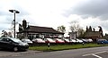
 A C Cars, Wych Cross - geograph.org.uk - 4899746.jpg 2,048 × 1,536; 951 KB
-
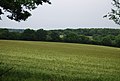 A field of Barley - geograph.org.uk - 3668844.jpg 640 × 430; 66 KB
-
 A gaunt tree - geograph.org.uk - 4118135.jpg 640 × 428; 105 KB
-
 A grassy footpath - geograph.org.uk - 3715434.jpg 640 × 430; 65 KB
-
 A grassy Sussex field - geograph.org.uk - 3707556.jpg 640 × 430; 72 KB
-
 A Hammer pond - geograph.org.uk - 3715575.jpg 640 × 430; 105 KB
-
 A line of pig huts - geograph.org.uk - 1691088.jpg 640 × 427; 69 KB
-
 A Lorry in a Field - geograph.org.uk - 320441.jpg 640 × 428; 101 KB
-
 A path on the edge of open heathland on Ashdown Forest - geograph.org.uk - 5345775.jpg 4,000 × 3,000; 4.64 MB
-
 A Peep over the Sewage Works Fence - geograph.org.uk - 326150.jpg 640 × 428; 82 KB
-
 A small dam - geograph.org.uk - 3715576.jpg 640 × 430; 103 KB
-
 A small woodland - geograph.org.uk - 4161532.jpg 640 × 430; 69 KB
-
 A Sussex meadow - geograph.org.uk - 4145925.jpg 640 × 430; 61 KB
-
 A Sussex Meadow - geograph.org.uk - 4161548.jpg 640 × 430; 73 KB
-

-
 A woodland path in Ashdown Forest - geograph.org.uk - 5405917.jpg 4,000 × 3,000; 4.91 MB
-
 A woodland track on Ashdown Forest - geograph.org.uk - 5345763.jpg 4,000 × 3,000; 4.89 MB
-
 A.C. Cars, Wych Cross, East Sussex - geograph.org.uk - 2962987.jpg 1,600 × 862; 254 KB
-
 A22 - geograph.org.uk - 5249399.jpg 640 × 426; 89 KB
-
 A22 at Forest Row - geograph.org.uk - 5844567.jpg 1,024 × 768; 257 KB
-
 A22 north to Forest Row - geograph.org.uk - 3223122.jpg 4,000 × 3,000; 3.3 MB
-
 A22 passing Broadstone Warren - geograph.org.uk - 5825048.jpg 1,024 × 768; 321 KB
-
 A22, Forest Row - geograph.org.uk - 5249398.jpg 640 × 426; 71 KB
-
 A22, Forest Row - geograph.org.uk - 5252489.jpg 640 × 426; 69 KB
-
 A22, northbound - geograph.org.uk - 5249401.jpg 640 × 426; 94 KB
-
 A22, southbound - geograph.org.uk - 5252483.jpg 640 × 426; 68 KB
-
 A264 - geograph.org.uk - 3330122.jpg 640 × 414; 32 KB
-
 A264 in Cinder Wood - geograph.org.uk - 2944979.jpg 640 × 430; 85 KB
-
 A264 in Fifty Acre Wood - geograph.org.uk - 2944986.jpg 640 × 430; 99 KB
-
 A264 in Fifty Acre Wood - geograph.org.uk - 2944987.jpg 640 × 430; 94 KB
-
 A264 in Reading's Wood - geograph.org.uk - 2944970.jpg 640 × 430; 93 KB
-
 A264 in the woods - geograph.org.uk - 2944972.jpg 640 × 430; 92 KB
-
 A264, eastbound - geograph.org.uk - 3330141.jpg 640 × 430; 49 KB
-
 A264, Fifty Acre Wood - geograph.org.uk - 2944990.jpg 640 × 430; 79 KB
-
 A264, Holtye Road - geograph.org.uk - 1948292.jpg 1,024 × 768; 261 KB
-
 A264, Holtye Road - geograph.org.uk - 1948300.jpg 1,024 × 768; 338 KB
-
 A264, Reading's Wood - geograph.org.uk - 3331380.jpg 640 × 430; 68 KB
-
 A264, westbound - geograph.org.uk - 3330120.jpg 640 × 359; 44 KB
-
 Abandoned limousine at Dodges Farm - geograph.org.uk - 2132251.jpg 2,592 × 1,944; 2.07 MB
-
 Above Weir Wood Reservoir - geograph.org.uk - 3715425.jpg 640 × 430; 68 KB
-
 Access road from Weir Wood Reservoir - geograph.org.uk - 3708020.jpg 640 × 430; 87 KB
-
 Acre Wood - geograph.org.uk - 4168667.jpg 640 × 430; 67 KB
-
 Across the field from the footbridge - geograph.org.uk - 5162211.jpg 800 × 600; 133 KB
-
 Aecen Gill, Forest Row, Sussex.png 1,102 × 699; 1.45 MB
-
 Ancient oak tree - geograph.org.uk - 2910749.jpg 1,600 × 900; 694 KB
-

-
 Approaching open heathland on Ashdown Forest - geograph.org.uk - 5345770.jpg 4,000 × 3,000; 4.69 MB
-
 Approaching the B2100 - geograph.org.uk - 2222043.jpg 640 × 430; 151 KB
-
 Approaching the Crossroads - geograph.org.uk - 4044315.jpg 4,000 × 2,666; 6.57 MB
-
 Ashdown Forest - geograph.org.uk - 2517040.jpg 640 × 480; 82 KB
-
 Ashdown Forest - geograph.org.uk - 3715591.jpg 640 × 430; 149 KB
-
 Ashdown Forest - geograph.org.uk - 3715597.jpg 640 × 430; 139 KB
-
 Ashdown Forest - geograph.org.uk - 3715601.jpg 640 × 430; 136 KB
-
 Ashdown Forest - geograph.org.uk - 3715605.jpg 640 × 430; 142 KB
-
 Ashdown Forest - spot the deer^ - geograph.org.uk - 1672036.jpg 640 × 428; 151 KB
-
 Ashdown Forest at Hindleap - geograph.org.uk - 5826104.jpg 1,024 × 615; 176 KB
-
 Ashdown Forest Llama Park - geograph.org.uk - 335022.jpg 640 × 480; 55 KB
-

-
-
 Ashdown Road, Forest Row - geograph.org.uk - 2103867.jpg 640 × 480; 80 KB
-
 Ashurst Wood Village Sign - geograph.org.uk - 5249414.jpg 640 × 426; 121 KB
-
 B2100 heading south - geograph.org.uk - 2222092.jpg 640 × 430; 130 KB
-
 B2100 to Hartfield - geograph.org.uk - 2222056.jpg 640 × 430; 131 KB
-
 B2110 - geograph.org.uk - 5252529.jpg 640 × 426; 82 KB
-
 B2110 to Hartfield - geograph.org.uk - 2222144.jpg 640 × 430; 150 KB
-
 B2110, Forest Row - geograph.org.uk - 5249381.jpg 640 × 426; 65 KB
-
 B2110, Forest Row - geograph.org.uk - 5252506.jpg 640 × 426; 80 KB
-
 Bank Cottage - geograph.org.uk - 2934996.jpg 640 × 430; 100 KB
-
 Baptist Chapel, Forest Row - geograph.org.uk - 317351.jpg 640 × 428; 91 KB
-
 Barley - geograph.org.uk - 3668881.jpg 640 × 430; 58 KB
-
 Barley field - geograph.org.uk - 3668864.jpg 640 × 430; 63 KB
-
 Barley in the Medway Valley - geograph.org.uk - 3668883.jpg 640 × 430; 59 KB
-
 Barley near Horseshoe Farm - geograph.org.uk - 3668863.jpg 640 × 430; 56 KB
-
 Barn at Little Water Farm - geograph.org.uk - 3471892.jpg 640 × 480; 132 KB
-
 Barn, Homestall - geograph.org.uk - 4145947.jpg 640 × 430; 86 KB
-
 Barn, Horseshoe Farm - geograph.org.uk - 3668870.jpg 640 × 430; 79 KB
-
 Barn, Owlett's Farm - geograph.org.uk - 4133538.jpg 640 × 430; 63 KB
-
 Barn, Owlett's Farm - geograph.org.uk - 4133541.jpg 640 × 430; 103 KB
-
 Barn, Spring Hill Farm - geograph.org.uk - 3715382.jpg 640 × 430; 72 KB
-
 Barn, Spring Hill Farm - geograph.org.uk - 3715401.jpg 640 × 430; 107 KB
-
 Beeches, Hammerwood - geograph.org.uk - 6093385.jpg 1,024 × 830; 759 KB
-
 Bench with a view, Ashdown Forest - geograph.org.uk - 5842461.jpg 1,024 × 768; 266 KB
-
 Bench with a view, near Forest Row - geograph.org.uk - 5842423.jpg 1,024 × 768; 288 KB
-
 Bench, Forest Way - geograph.org.uk - 1691127.jpg 640 × 427; 117 KB
-
 Bend in B2110 - geograph.org.uk - 2222138.jpg 640 × 430; 159 KB
-
 Bend, A264 - geograph.org.uk - 3331378.jpg 640 × 430; 62 KB
-
 Bird Watchers at Weir Wood Reservoir - geograph.org.uk - 3878567.jpg 3,072 × 2,048; 1.49 MB
-
 Black Windmill Cottages - geograph.org.uk - 4058137.jpg 640 × 480; 98 KB
-

-
 Blackberry Hill Radio Mast - geograph.org.uk - 1690093.jpg 640 × 427; 44 KB
-
 Blackberry Hill Radio Mast - geograph.org.uk - 1690337.jpg 640 × 427; 60 KB
-
 Blackberry Hill Radio Mast, in the woods - geograph.org.uk - 1690113.jpg 427 × 640; 131 KB
-
 Blackhole in Brakey Shaw - geograph.org.uk - 3224102.jpg 4,000 × 3,000; 3.53 MB
-
 Blacklands crescent - geograph.org.uk - 2877751.jpg 1,913 × 870; 1.18 MB
-
 Blacklands Crescent off Hartfield Rd - geograph.org.uk - 1701238.jpg 640 × 427; 79 KB
-
 Blacklands Farm Allotments - geograph.org.uk - 1691162.jpg 640 × 427; 108 KB
-
 Blacklands Farm Allotments, Forest Row - geograph.org.uk - 1691149.jpg 640 × 427; 132 KB
-
 Blue tits on birdfeeders, Weir Wood Reservoir - geograph.org.uk - 3372064.jpg 1,194 × 1,600; 242 KB
-
 Bluebells at Brakey Shaw - geograph.org.uk - 3453768.jpg 640 × 480; 156 KB
-
 Boat racing on Weirwood Reservoir - geograph.org.uk - 1701367.jpg 510 × 640; 55 KB
-
 Boats racing, Weirwood Reservoir - geograph.org.uk - 1701362.jpg 640 × 512; 57 KB
-
 Boggy hollow in Spanden Wood - geograph.org.uk - 1691049.jpg 640 × 427; 124 KB
-
 Boggy pond by the Forest Way - geograph.org.uk - 1700852.jpg 640 × 427; 128 KB
-
 Bower Lodge, Hammerwood - geograph.org.uk - 4671975.jpg 2,304 × 1,728; 1.46 MB
-
 Brambletye Crossing - geograph.org.uk - 3662860.jpg 640 × 430; 118 KB
-
 Brambletye crossing, Forest Way - geograph.org.uk - 5842403.jpg 1,024 × 768; 314 KB
-
 Brambletye Hotel, Forest Row - geograph.org.uk - 2103837.jpg 640 × 480; 66 KB
-
 Brambletye House, near Forest Row - geograph.org.uk - 5842419.jpg 1,024 × 768; 232 KB
-
 Brambletye Lane - geograph.org.uk - 1700808.jpg 640 × 427; 95 KB
-
 Brambletye Lane, near Forest Row - geograph.org.uk - 5842407.jpg 1,024 × 768; 261 KB
-
 Bridge across Forest Way, near Forest Row - geograph.org.uk - 5844514.jpg 1,024 × 768; 316 KB
-
 Bridge at Forest Row - geograph.org.uk - 4043756.jpg 4,000 × 2,666; 6.93 MB
-
 Bridge on Forest Way near East Grinstead - geograph.org.uk - 5842380.jpg 1,024 × 768; 331 KB
-

-
 Bridge over Forest Way - geograph.org.uk - 2221999.jpg 640 × 430; 187 KB
-
 Bridge over Forest Way - geograph.org.uk - 3300637.jpg 4,000 × 3,000; 3.36 MB
-
 Bridge over Forest Way path - geograph.org.uk - 3469308.jpg 640 × 427; 164 KB
-
 Bridge over Forest Way path - geograph.org.uk - 3469311.jpg 640 × 427; 173 KB
-
 Bridge over Forest Way, Forest Row - geograph.org.uk - 5844520.jpg 1,024 × 768; 359 KB
-
 Bridge with a gap - geograph.org.uk - 5149050.jpg 800 × 600; 182 KB
-
 Bridleway Forest Row 17g - geograph.org.uk - 4118078.jpg 428 × 640; 159 KB
-
 Bridleway in Mill Wood - geograph.org.uk - 1950303.jpg 3,072 × 2,304; 2.64 MB
-
 Bridleway junction - geograph.org.uk - 3662814.jpg 640 × 430; 94 KB
-
 Bridleway junction by Owletts Cottage - geograph.org.uk - 3302145.jpg 4,000 × 3,000; 3.51 MB
-
 Bridleway only^ - geograph.org.uk - 5149760.jpg 800 × 600; 188 KB
-
 Bridleway through Ashdown Forest - geograph.org.uk - 5842451.jpg 1,024 × 768; 341 KB
-
 Bridleway through Holden Wood - geograph.org.uk - 4118091.jpg 428 × 640; 193 KB
-
 Bridleway to Ashurst Wood - geograph.org.uk - 3662850.jpg 640 × 430; 94 KB
-
 Bridleway to Ashurst Wood - geograph.org.uk - 3662854.jpg 640 × 430; 110 KB
-
-
 Bridleway to Great Cansiron Farm - geograph.org.uk - 4168666.jpg 640 × 430; 93 KB
-
 Bridleway to Great Cansiron Farm - geograph.org.uk - 4168670.jpg 640 × 430; 75 KB
-
 Bridleway to Hammerwood - geograph.org.uk - 4145743.jpg 640 × 430; 92 KB
-
 Bridleway to nowhere - geograph.org.uk - 1951103.jpg 2,304 × 3,072; 2.32 MB
-
 Bridleway, Highams Wood - geograph.org.uk - 317198.jpg 640 × 428; 178 KB
-
 Briskly flowing under the Forest Way - geograph.org.uk - 3815670.jpg 800 × 600; 141 KB
-
 Broadstone Warren - geograph.org.uk - 5825037.jpg 768 × 1,024; 214 KB
-
 Broadstone Warren, Ashdown Forest (1) - geograph.org.uk - 6074038.jpg 1,024 × 768; 725 KB
-
 Broadstone Warren, Ashdown Forest (2) - geograph.org.uk - 6074040.jpg 1,024 × 768; 641 KB
-
 Brookers Bottom - geograph.org.uk - 5847785.jpg 1,600 × 1,002; 462 KB
-
 Brooklands - geograph.org.uk - 4145848.jpg 640 × 430; 78 KB
-
 Brooklands - geograph.org.uk - 4145853.jpg 640 × 430; 90 KB
-
 Brooklands Farm - geograph.org.uk - 4145870.jpg 640 × 430; 82 KB
-
 Building in Plaw Hatch Farm - geograph.org.uk - 5745478.jpg 3,672 × 4,896; 5.78 MB
-
 Building in wood near Thornhill - geograph.org.uk - 3471906.jpg 640 × 480; 145 KB
-
 Bulls near Weir Wood Cottages - geograph.org.uk - 3453723.jpg 640 × 480; 78 KB
-
 Buoy, Weir Wood Reservoir - geograph.org.uk - 3662457.jpg 640 × 430; 45 KB
-
 Burnthouse Farm - geograph.org.uk - 1700859.jpg 640 × 427; 54 KB
-
 Bus on Wall Hill Rd - geograph.org.uk - 5252478.jpg 640 × 426; 59 KB
-
 Bus shelter, Forest Row - geograph.org.uk - 2103835.jpg 640 × 480; 94 KB
-

-
 Busses Wood - geograph.org.uk - 3699588.jpg 640 × 430; 136 KB
-
 Busses Wood - geograph.org.uk - 3699593.jpg 640 × 430; 139 KB
-
 Busses Wood - geograph.org.uk - 3699595.jpg 640 × 430; 133 KB
-
 Busses Wood - geograph.org.uk - 3699599.jpg 640 × 430; 132 KB
-
 Buttercup meadow - geograph.org.uk - 4154504.jpg 640 × 430; 93 KB
-
 Buttercup meadow - geograph.org.uk - 4154512.jpg 640 × 430; 117 KB
-
 Buttercup meadow - geograph.org.uk - 4168391.jpg 640 × 430; 93 KB
-
 By Dog Gate Lodge - geograph.org.uk - 4117905.jpg 640 × 428; 176 KB
-
 By the golf course, Ashdown Forest - geograph.org.uk - 1672033.jpg 640 × 428; 132 KB
-
 By the Vanguard Way - geograph.org.uk - 4144355.jpg 640 × 430; 56 KB
-
 Byway meets A264 - geograph.org.uk - 4105831.jpg 640 × 428; 138 KB
-
 Calves near Little Water Farm - geograph.org.uk - 3471878.jpg 640 × 480; 123 KB
-
 Cansiron Lane (path) - geograph.org.uk - 3302154.jpg 4,000 × 3,000; 3.46 MB
-
 Cansiron Lane - geograph.org.uk - 5149726.jpg 800 × 600; 171 KB
-
 Cansiron Lane going south - geograph.org.uk - 5149740.jpg 800 × 600; 181 KB
-
 Cansiron Lane looking north - geograph.org.uk - 5149755.jpg 800 × 600; 166 KB
-
 Car park at Weir Wood Reservoir - geograph.org.uk - 3662439.jpg 640 × 430; 66 KB
-
 Caravan in the car park of Catholic church - geograph.org.uk - 3203147.jpg 3,264 × 2,448; 4.66 MB
-
 Carpet of Sweet Chestnut leaves in Plaw Wood - geograph.org.uk - 2132175.jpg 2,592 × 1,944; 2.26 MB
-
 Cattle grazing - geograph.org.uk - 3668836.jpg 640 × 430; 82 KB
-
 Cattle grazing - geograph.org.uk - 4133141.jpg 640 × 430; 49 KB
-
 Cattle grazing - geograph.org.uk - 4133165.jpg 640 × 430; 52 KB
-
 Cattle grazing, Forest Row - geograph.org.uk - 5844530.jpg 1,024 × 768; 284 KB
-
 Cattle grid at the entrance to Mayes House and farm - geograph.org.uk - 3257539.jpg 4,000 × 3,000; 3.41 MB
-
 Cemetery chapel - geograph.org.uk - 2764696.jpg 1,600 × 900; 493 KB
-
 Chain saw sculpture - geograph.org.uk - 2651249.jpg 1,600 × 1,200; 689 KB
-
 Chain saw sculpture - geograph.org.uk - 2651255.jpg 640 × 480; 123 KB
-
 Chalybeate Spring in Kidbrooke Wood - geograph.org.uk - 3223144.jpg 4,000 × 3,000; 3.56 MB
-
 Chapel Lane - geograph.org.uk - 2928657.jpg 640 × 430; 72 KB
-
 Chapel Lane Forest Row - geograph.org.uk - 3221819.jpg 4,000 × 3,000; 3.47 MB
-
 Chapel Lane, Forest Row - geograph.org.uk - 2103869.jpg 640 × 480; 74 KB
-
 Chapel Lane, Forest Row - geograph.org.uk - 2428584.jpg 718 × 538; 126 KB
-
 Chapel Lane, Forest Row in 1967 - geograph.org.uk - 2448520.jpg 1,044 × 686; 183 KB
-
 Chapel, Forest Row - geograph.org.uk - 2928650.jpg 640 × 430; 82 KB
-
 Chequers Inn, Forest Row - geograph.org.uk - 2103829.jpg 640 × 480; 75 KB
-
 Cherry tree and pond at Culver Farm - geograph.org.uk - 3468542.jpg 640 × 427; 154 KB
-
 Church in Hammerwood - geograph.org.uk - 4671974.jpg 2,170 × 1,532; 1.59 MB
-
 Church of The Holy Trinity - geograph.org.uk - 5249390.jpg 640 × 426; 60 KB
-
 Church of The Holy Trinity - geograph.org.uk - 5249392.jpg 640 × 426; 51 KB
-
 Church of The Holy Trinity - geograph.org.uk - 5252496.jpg 640 × 426; 58 KB
-
 Church of The Holy Trinity - geograph.org.uk - 5252500.jpg 640 × 426; 57 KB
-
 Church on Lewes Road, Forest Row - geograph.org.uk - 2459245.jpg 1,600 × 1,200; 517 KB
-
 Clump of trees surrounding car park on Hindleap Lane - geograph.org.uk - 3225332.jpg 4,000 × 3,000; 3.57 MB
-
 Cobbers Cottage by Catland Shaw - geograph.org.uk - 1691840.jpg 640 × 427; 64 KB
-
 Cobbers house in the lee of Catland Shaw - geograph.org.uk - 3300591.jpg 4,000 × 3,000; 3.44 MB
-

-
 Collingsbrush Wood - geograph.org.uk - 3470587.jpg 640 × 427; 192 KB
-
 Commemorative J F Kennedy plaque - geograph.org.uk - 2764753.jpg 1,600 × 900; 273 KB


_-_geograph.org.uk_-_6074038.jpg)
_-_geograph.org.uk_-_6074040.jpg)


_-_geograph.org.uk_-_3302154.jpg)


